


Riederberghöhe
 |
AT (NÖ), 16.0944°E, 48.2502°N | |||
 |
384 m |  |
AT-3-0384 | |
 |
Gablitz, 290m, 5km | |||
 |
Ried, 240m, 4km | |||
 |


")
| |||
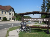
Exagerated elevation on the signpost! | ||||
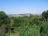
Sight from Riederberg to the north-west, with the plain of the Danube river behind the hills | ||||