


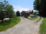
Chrummentürli
 |
CH (SG), 9.1135°E, 47.3953°N | |||
 |
783 m |  |
CH-SG-0783 | |
 |
Tufertschwil | |||
 |
Oberrindal | |||
 |


")
| |||
 |
(noch nicht auf Deutsch übersetzt:) route goudronnée versant vallée de la Necker | |||
Chrummentürli | ||||
|
CH (SG), 9.1135°E, 47.3953°N | |||
|
783 m | |
CH-SG-0783 | |
|
Tufertschwil | |||
|
Oberrindal | |||
|
| |||
|
(noch nicht auf Deutsch übersetzt:) route goudronnée versant vallée de la Necker | |||
|
Chrummentürli | ||||