


Schwängihöchi
 |
CH (BL), 7.7869°E, 47.3478°N | |||
 |
905 m |  |
CH-BL-0905 | |
 |
Hägendorf, 434m, 8km | |||
 |
Langenbruck, 697m, 2km | |||
 |
||||
 |


")
| |||
 |
easy climb from the west side, harder from the east (or with a long detour) | |||
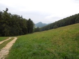
Schwängihöchi, view towards north-east, in the background (right) Wuesthöchi | ||||
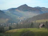
Langenbruck, south of Ober Hauenstein (view taken from Schwängi) | ||||
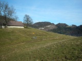
Schwängihöchi, view to the west | ||||