


Spitzenmatt
 |
CH (LU), 8.0444°E, 47.0023°N | |||
 |
914 m | |||
 |
Doppleschwand, 751m, 3km Schwandsagi, 722m, 2km | |||
 |
Entlebuch, 683m, 3km | |||
 |


")
| |||
 |
paved on the sout-east side, good gravel road on the north-west | |||

The Spitzenmatt chapel | ||||
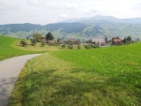
The Entlebuch valley as seen from Spitzenmatt | ||||