


Passwang
 |
CH (SO), 7.656°E, 47.3578°N | |||
 |
943 m |  |
CH-SO-0943 | |
 |
Balsthal, 495m, 11km Mümliswil, 556m, 7km Ramiswil, 637m, 4km | |||
 |
Breitenbach, 390m, 15km Erschwil, 455m, 11km Oberbeinwil, 594m, 5km | |||
 |


")

")
| |||

Chapel of Vorderbeibelberg on the south side of Passwang | ||||

Passwang road in the descent towards Beinwil | ||||

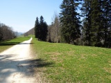
The Guldental valley and the road up to the Passwang | ||||

The north entrance of the Passwang tunnel | ||||
The Passwang crest above the tunnel | ||||