


Wolfsgrueb
 |
CH (ZH), 8.952°E, 47.2967°N | |||
 |
972 m |  |
CH-SG-0971a | |
 |
Wald, 615m, 5km Fälmis, 840m, 1km | |||
 |
Steg, 706m, 7km Vorder Töss, 843m, 1km | |||
 |
||||
 |


")
| |||
 |
very steep on both sides of the pass, surfaced road on the south | |||
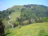
Wolfsgrueb and, in the background, the Scheidegg crest | ||||