


Ulmethöhe
 |
CH (BL), 7.6572°E, 47.3803°N | |||
 |
973 m |  |
CH-BL-0973 | |
 |
Lauwil, 633m, 4km | |||
 |
Oberbeinwil, 594m, 7km | |||
 |
||||
 |


")
| |||
 |
small paved road on the north side, gravel road on the south | |||
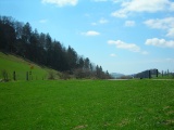
Ulmethöhe, view to the south-west | ||||

Ulmethöhe, view to the north-east | ||||