


Schallenbergpass
 |
CH (BE), 7.7969°E, 46.8262°N | |||
 |
1167 m |  |
CH-BE-1167 | |
 |
Schangnau, 930m, 7km Tal, 841m, 5km | |||
 |
Schwarzenegg, 916m, 10km | |||
 |


")
")

")
| |||
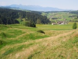
View over Oberei from the street up to Schallenberg | ||||
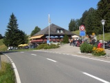
Schallenberg | ||||
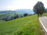
Schallenberg, view to the east with the Schrattenfluh mountain | ||||