


Ruchegg
 |
CH (SZ), 8.7031°E, 47.102°N | |||
 |
1206 m |  |
CH-SZ-1220 | |
 |
Rothenthurm, 923m, 4km | |||
 |
Trachslau, 938m, 3km | |||
 |
||||
 |


")
| |||
 |
(not yet translated into English:) facilement cyclable sur versant Rothenthurm, raide et dernier demi-kilomètre de mauvais sentier sur versant Trachslau | |||
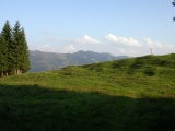
Ruchegg and the Alptal | ||||