


Chlepfütte
 |
CH (AI), 9.3626°E, 47.3082°N | |||
 |
1224 m | |||
 |
Gonten, 903m, 4km | |||
 |
Gontenbad, 884m, 6km | |||
 |


")
| |||
 |
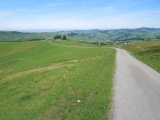
road from Gonten | |||
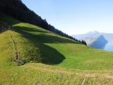
Chlepfhütte | ||||
Fälmissattel with the Pilatus and Bürgenstock mountains | ||||
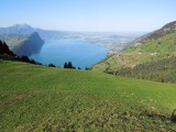
View on the lake of Four Cantons and on Lucerne from Fälmissattel | ||||
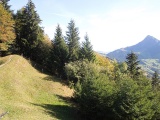
Fälmissattel, view towards Gätterlipass and Hoflue to its right | ||||