


Fälmissattel
 |
CH (LU-SZ), 8.5109°E, 47.0081°N | |||
 |
1224 m |  |
CH-LU-1224 | |
 |
Vitznau | |||
 |
Gersau | |||
 |
||||
 |


")
| |||
 |
reachable via the ridge path Fälmisegg - Vitznauerstock | |||
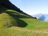
Fälmissattel with the Pilatus and Bürgenstock mountains | ||||
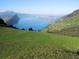
View on the lake of Four Cantons and on Lucerne from Fälmissattel | ||||
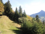
Fälmissattel, view towards Gätterlipass and Hoflue to its right | ||||