


Schinliegg
 |
CH (BE), 7.9007°E, 46.9922°N | |||
 |
1245 m | |||
 |
Fankhaus, 871m, 5km | |||
 |
Goldbachbrügg, 962m, 2km | |||
 |


")
| |||
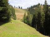
Schinliegg vom Süden her | ||||
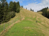
Milpachsattel und der Pfad nach Schinliegg hinauf | ||||
|
CH (BE), 7.9007°E, 46.9922°N | |||
|
1245 m | |||
|
Fankhaus, 871m, 5km | |||
|
Goldbachbrügg, 962m, 2km | |||
|
| |||
|
Schinliegg vom Süden her | ||||
|
Milpachsattel und der Pfad nach Schinliegg hinauf | ||||