


Col des Jognins
 |
CH (FR), 7.1723°E, 46.6007°N | |||
 |
1343 m |  |
CH-FR-1343 | |
 |
Motélon, 980m, 2km | |||
 |
Bonnefontaine, 875m, 3km | |||
 |
||||
 |


")
| |||
 |
(not yet translated into English:) route extrêmement raide côté Montélon, sentier avec passages assez difficiles côté Bonnefontaine | |||
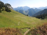
View towards Col des Jognins from Col des Combes | ||||
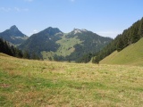
View towards Col des Combes from Col des Jognins | ||||
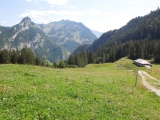
Col des Jognins on the Jaun valley's side, with the Pointe sur le Roc and Gros Brun mountains | ||||
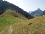
Le Col des Jognins en descendant depuis Les Plans | ||||