


Schwarzenegghöchi
 |
CH (SZ), 8.9469°E, 47.1047°N | |||
 |
1365 m |  |
CH-SZ-1365 | |
 |
Vorderthal, 713m, 10km Ramseli, 1095m, 3km Trepsen, 1358m, 1km | |||
 |
Innerthal, 906m, 4km | |||
 |
||||
 |


")
| |||
 |
sentiers souvent mouillés entre Ramseli et le col (poussages), bons chemins pour le reste | |||
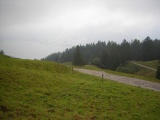
Vue de Schwarzenegg sur le Wägital | ||||