


Mättler Höhi
 |
CH (SG), 9.1303°E, 47.1726°N | |||
 |
1578 m |  |
CH-SG-1578 | |
 |
Stein, 838m, 11km Hinter Höhi, 1416m, 3km Vordermatt, 1400m, 1km | |||
 |
Weesen, 423m, 12km Durschlegi, 1127m, 5km Hintermatt, 1429m, 1km | |||
 |
||||
 |


")
| |||
 |
good roads up to Vordermatt and Hintermatt, respectively; pushing necessary above | |||

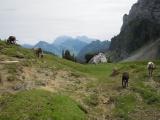
From Vordermatt up to Mättler Höhi | ||||
Mättler Höhi, view to the north-east with the Säntis | ||||

Mättler Höhi, view to the south-west (Hintermatt) | ||||