


Passo di Pianca Bella
 |
CH-IT (TI-CO), 9.0657°E, 46.062°N | |||
 |
1677 m |  |
CH-TI-1677a | |
 |
, 1080m Cimadera, 1080m, 5km Mosè, 1520m, 2km | |||
 |
Dasio, 580m, 5km Cime di Noga, 1511m, 2km Alpe di Dasio, 1397m, 1km | |||
 |
||||
 |


")
| |||
 |
(noch nicht auf Deutsch übersetzt:) chemin raide jusqu'à l'alpage de Pianca Bella, sentier plus haut; sentiers longs et très raides du côté italien | |||
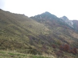
Sicht von Pianca Bella in Richtung Passo di Pianca Bella | ||||
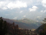
Das Val Colla aus dem Passo Pianca Bella her gesehen | ||||