


Auenfeldsattel
 |
AT (VA), 10.1372°E, 47.2394°N | |||
 |
1710 m |  |
AT-8-1710 | |
 |
Schröcken, 1269m, 6km Batzenalpe, 1572m, 3km | |||
 |
Lech, 1454m, 3km | |||
 |
||||
 |


")
| |||
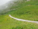
Way arriving at Auenfeldsattel from the north-west | ||||
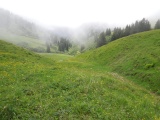
Gaisbachtobel small valley from Auenfeldsattel down to Lechtal valley | ||||