


Chamm
 |
CH (SG), 9.4243°E, 47.0856°N | |||
 |
1712 m | |||
 |
Azmoos, 495m, 11km | |||
 |
Berschis, 444m, 17km Rietälpli, 1700m, 4km Hinter Palfris, 1630m, 2km | |||
 |
||||
 |


")
| |||
 |
surface road from Azmoos, signposted track over Palfris and Gastilun, entirely cyclable and with nice views | |||
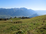
The Rhine valley and the Lichtenstein mountains as seen from Chamm | ||||
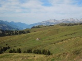
Palfris and the Churfirsten | ||||
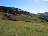
Palfris | ||||