


Col des Saluces
 |
FR (05), 6.6497°E, 44.5837°N | |||
 |
2444 m |  |
FR-05-2444 | |
 |
Siguret | |||
 |
Les Claux | |||
 |
||||
 |


")
| |||

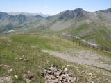
In Richtung zum Vars Pass aus dem Saluces pass | ||||
Vom Gipfel der Mayt, der Pass von Jaffeuil, der Pic de Chabrières und, näher, der Saluces Pass | ||||