


Sustenpass
 |
CH (BE-UR), 8.4477°E, 46.7296°N | |||
 |
2224 m |  |
CH-BE-2224b | |
 |
Innertkirchen, 625m, 27km | |||
 |
Wassen, 916m, 21km | |||
 |
||||
 |


")
")

")
| Tour 1992 Tour 2010 Tour 2014 | ||
 |
pass between the cantons of Berne and Uri, good road, hilltop tunnel (true pass at 2264 m) | |||

Meien | ||||

The Meiental as seen from Guferalp, on the Uri slope of the Susten | ||||
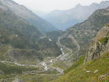
The Bernese slope of the Susten | ||||