
 MTB tour Nesslau - Risi - Gräppelen - Alt-St-Johann - Nesslau (10 November 2011)
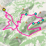 |
38 km |
| 1293 m ^ | |
 |
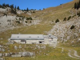
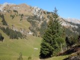
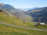
Above Stein, view into the valley of the Weisse Thur 10-11-2011 10:46 9.2308°E, 47.2042°N, 960m |
 |
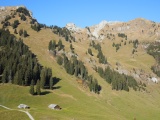
Risipass, View towards Lütispitz and Säntis 10-11-2011 11:32 9.2503°E, 47.2194°N, 1459m |
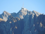 |
The Säntis 10-11-2011 11:33 9.2503°E, 47.2194°N, 1459m |
 |
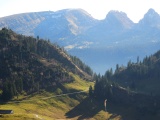
Schwägalp and the Säntis as seen from Risipass 10-11-2011 11:59 9.2611°E, 47.2181°N, 1610m |
 |
Alpli, view towards Lütispitz 10-11-2011 12:06 9.2633°E, 47.2175°N, 1680m |
 |
View from Alpli towards Wildhaus, with the Rhine valley in the fog 10-11-2011 12:06 9.2636°E, 47.2175°N, 1680m |
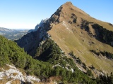 |
Windenpass and Lütispitz 10-11-2011 12:22 9.2697°E, 47.2197°N, 1700m |
 |
Windenpass, view to the south-east 10-11-2011 12:42 9.2736°E, 47.2206°N, 1620m |
 |
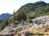
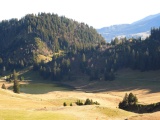
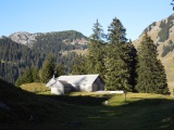
The alp of Hinterwinden and the Windenpass 10-11-2011 12:53 9.2731°E, 47.2181°N, 1550m |
 |
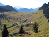
From Foggboden towards Hinterwinden 10-11-2011 12:58 9.2769°E, 47.2136°N, 1430m |
 |
The small lake of Gräppelen and Chrinn 10-11-2011 12:58 9.2769°E, 47.2136°N, 1430m |
 |
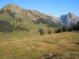
Böstritt and, in the background, three of the Churfirsten: Hinterrugg, Schibenstoll and Zuestoll 10-11-2011 12:59 9.2769°E, 47.2136°N, 1430m |
 |
Rietegg as seen from Foggboden (Gräppelen) 10-11-2011 12:59 9.2769°E, 47.2136°N, 1430m |
 |
Gräppelen and Wildhuser Schafberg 10-11-2011 13:09 9.2892°E, 47.2128°N, 1320m |
 |
Wildhuser Schafberg 10-11-2011 13:09 9.2892°E, 47.2128°N, 1320m |
 |
View from Chrinn towards Gamschopf and Säntis 10-11-2011 13:19 9.2900°E, 47.2106°N, 1349m |
 |
View from Chrinn towards Lütispitz and Gamschopf 10-11-2011 13:19 9.2900°E, 47.2106°N, 1349m |
 |
The small lake of Gräppelen 10-11-2011 13:23 9.2853°E, 47.2100°N, 1330m |
 |
Böstritt, view towards Windenpass 10-11-2011 13:28 9.2797°E, 47.2064°N, 1343m |
 |
Gräppelen vu de Rietegg, avec Lütispitz, Säntis et Wildhuser Schafberg 10-11-2011 13:35 9.2672°E, 47.2050°N, 1403m |
 |
Unterwasser and Wildhaus as seen from above Alt-St-Johann 10-11-2011 13:42 9.2658°E, 47.1958°N, 1260m |