
 MTB tour Altdorf - Surenenpass - Engelberg - Grafenort (6 September 2014)
 |
42 km |
| 2073 m ^ | |
 |
Lake of Uri, with Seedorf and Flüelen, as seen from Heretwis above Attinghausen 06-09-2014 08:34 8.6064°E, 46.8733°N, 850m |
 |
Altdorf, Bürglen, Schattdorf 06-09-2014 08:49 8.6122°E, 46.8661°N, 990m |
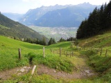 |
Path near Stückiberg with view over Altdorf 06-09-2014 09:26 8.6122°E, 46.8433°N, 1300m |
 |
Höchiberg, with the Schächentaler Windgällen at the horizon 06-09-2014 09:41 8.6089°E, 46.8411°N, 1440m |
 |
The valley of Waldnacht 06-09-2014 10:35 8.5950°E, 46.8394°N, 1400m |
 |
Waldnacht as seen from the path climbing to Eifrutt 06-09-2014 11:13 8.5672°E, 46.8372°N, 1680m |
 |
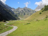
Restibiel and Eifrutt 06-09-2014 11:40 8.5608°E, 46.8386°N, 1860m |
 |
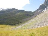
Brunnifurggi 06-09-2014 12:19 8.5589°E, 46.8433°N, 2053m |
 |
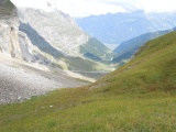
View from Brunnifurggi towards Surenenpass 06-09-2014 12:20 8.5589°E, 46.8433°N, 2053m |
 |
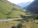
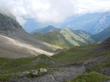
The valley of Gitschi from Brunnifurggi 06-09-2014 12:20 8.5589°E, 46.8433°N, 2053m |
 |
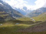
Surenenpass, view to the east 06-09-2014 13:18 8.5458°E, 46.8364°N, 2291m |
 |
Surenenpass, view to the southeast and the Titlis 06-09-2014 13:19 8.5458°E, 46.8364°N, 2291m |
 |
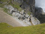
Alp of Blacken 06-09-2014 13:52 8.5158°E, 46.8261°N, 1780m |
 |
Chapel of Blacken 06-09-2014 14:08 8.5139°E, 46.8247°N, 1760m |
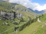 |
The valley of Surenen 06-09-2014 14:31 8.5000°E, 46.8022°N, 1500m |
 |
View towards Engelberg from Herrenrüti 06-09-2014 14:46 8.4594°E, 46.7964°N, 1130m |