
 Tour 2020, stage 1: Ringlikon - Luzern - Langnau i. E. - Liebefeld (25 June 2020)
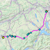 |
151 km |
| 2160 m ^ | |
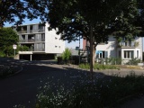 |
Geissmatthöhe in the city of Lucerne 25-06-2020 09:24 8.2992°E, 47.0569°N, 480m |
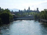 |
Lucerne, the Reuss river and the Musegg city walls 25-06-2020 09:31 8.2919°E, 47.0553°N, 440m |
 |
Rengg pass seen for the north-east 25-06-2020 10:43 8.1033°E, 47.0150°N, 890m |
 |
The hairpin curves of the Rengg pass on the Entlebuch side 25-06-2020 11:07 8.0903°E, 47.0033°N, 950m |
 |
Heiterloch, side Gross Fontanne 25-06-2020 12:00 8.0325°E, 46.9808°N, 932m |
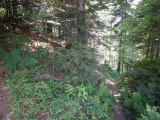 |
Path from Hasle arriving at Heiterloch 25-06-2020 12:01 8.0325°E, 46.9808°N, 932m |
 |
The valley of Gross Fontanne from Schüpferegg 25-06-2020 12:14 8.0081°E, 46.9708°N, 1019m |
 |
Schüpfheim 25-06-2020 12:21 8.0119°E, 46.9569°N, 720m |
 |
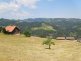
Eggelried, view to the east 25-06-2020 14:30 7.7217°E, 46.9417°N, 860m |
 |
Eggelriedegg 25-06-2020 14:40 7.7153°E, 46.9408°N, 940m |
 |
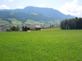
The Emmental valley from Eggelriedegg 25-06-2020 14:40 7.7153°E, 46.9408°N, 940m |
 |
View over Langnau from Moosegg 25-06-2020 14:45 7.7119°E, 46.9461°N, 950m |
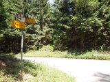 |
Hinderegg 25-06-2020 14:53 7.6961°E, 46.9422°N, 1000m |
 |
Pass of Tanne towards d'Arnisäge 25-06-2020 15:12 7.6481°E, 46.9472°N, 900m |
 |
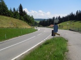
Hammegg 25-06-2020 15:19 7.6428°E, 46.9508°N, 952m |
 |
View to the south-east from Chrini 25-06-2020 16:06 7.5883°E, 46.9594°N, 851m |