
 Tour 2022, étape 2: Plaffeien - Broc - Les Paccots - Villeneuve (12 août 2022)
 |
89 km |
| 2100 m ^ | |
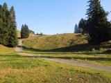 |
Feyersaga dans la vallée de Plasselbschlund 12/08/2022 08:30 7.2225°E, 46.7044°N, 1040m |
 |
Vue vers le nord (Plasselbschlund) depuis l'Auta Chia d'Amont 12/08/2022 09:20 7.2267°E, 46.6672°N, 1456m |
 |
Vue en direction du massif du Gros Brun (Schopfenspitz) depuis l'Auta Chia d'Amont 12/08/2022 09:21 7.2267°E, 46.6672°N, 1456m |
 |
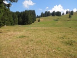
Dans le Val de Charmey 12/08/2022 09:31 7.2053°E, 46.6619°N, 1340m |
 |
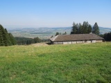
La Valsainte 12/08/2022 09:42 7.1881°E, 46.6481°N, 1010m |
 |
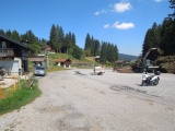
Le Cergny 12/08/2022 11:02 6.9800°E, 46.5950°N, 1150m |
 |
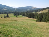
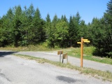
Les routes ne se joignent pas entre les communes de Vaulruz et Semsales 12/08/2022 11:12 6.9739°E, 46.5889°N, 1220m |
 |
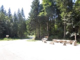
Au Pertuis (Le Plané) 12/08/2022 11:25 6.9550°E, 46.5778°N, 1185m |
 |
Vers le sud-ouest depuis le Pertuis 12/08/2022 11:26 6.9550°E, 46.5778°N, 1185m |
 |
Col des Joncs 12/08/2022 12:27 6.9508°E, 46.5122°N, 1197m |
 |
Des Joncs en direction du sud 12/08/2022 12:29 6.9494°E, 46.5089°N, 1190m |
 |
Sentier des Joncs descendant vers la passerelle Fégire 12/08/2022 12:37 6.9472°E, 46.5075°N, 1140m |
 |
Passerelle Fégire sur la Veveyse de Fégire 12/08/2022 12:55 6.9422°E, 46.5017°N, 1020m |
 |
Près de Ste-Hélène, vue par dessus la Veveyse de Fégire avec le col des Joncs sur la droite 12/08/2022 13:24 6.9464°E, 46.4972°N, 1190m |
 |
Alpage de Fontanna David 12/08/2022 13:28 6.9436°E, 46.4939°N, 1190m |
 |
Col de l'Alliaz 12/08/2022 13:32 6.9339°E, 46.4908°N, 1198m |
 |
Creux aux Oies 12/08/2022 13:35 6.9303°E, 46.4883°N, 1153m |
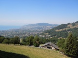 |
Vue en direction de Vevey depuis en dessous de Saumont, avec le lac Léman et le Mont Pélerin 12/08/2022 13:51 6.9211°E, 46.4572°N, 940m |
 |
Les Avants depuis le col de Sonloup 12/08/2022 14:12 6.9392°E, 46.4572°N, 1150m |