
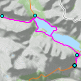
 MTB tour Torri di Fraéle - Valle Alpisella - S. Giacomo di Fraéle - Torri di Fréle (27 July 2023)
 |
29 km |
| 470 m ^ | |
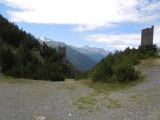 |
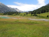
Torri di Fraéle with Cima de Piazzi on the left 27-07-2023 12:31 10.3106°E, 46.5025°N, 1940m |
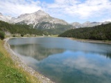 |
Lago di Fraéle and Monte Solena 27-07-2023 12:34 10.3128°E, 46.5078°N, 1930m |
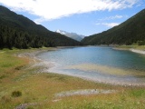 |
Lago di Fraéle und Cima de Piazzi 27-07-2023 12:38 10.3169°E, 46.5117°N, 1930m |
 |
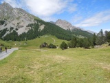
From Casina del Lago to the east 27-07-2023 12:40 10.3186°E, 46.5128°N, 1930m |
 |
Cancano dam, Monte Solena and, further to the left, Monte Cornaccia 27-07-2023 12:43 10.3172°E, 46.5144°N, 1940m |
 |
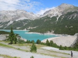
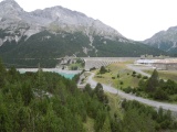
Lake Cancano and San Giacomo di Fraéle dam 27-07-2023 12:53 10.2997°E, 46.5225°N, 1940m |
 |
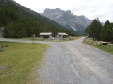
Casine Doscopa, near the S. Giacomo refuge 27-07-2023 13:10 10.2608°E, 46.5367°N, 1980m |
 |
Casine Doscopa 27-07-2023 13:14 10.2544°E, 46.5378°N, 1960m |
 |
Goats at the Alpisella pass 27-07-2023 14:24 10.2064°E, 46.5514°N, 2280m |
 |
Alpisella pass to the east 27-07-2023 14:26 10.2047°E, 46.5519°N, 2290m |
 |
Alpisella pass to the west 27-07-2023 14:28 10.2047°E, 46.5519°N, 2290m |
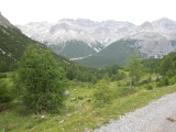 |
Towards Piz Murtaröl from the Alpisella valley 27-07-2023 14:57 10.2406°E, 46.5456°N, 2150m |
 |
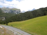
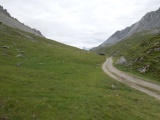
Winding gravel road in the bottom part of the Alpisella valley 27-07-2023 15:07 10.2492°E, 46.5489°N, 1990m |
 |
Passo di Fréle and Monte Cassa del Ferro 27-07-2023 15:17 10.2533°E, 46.5525°N, 1952m |
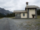 |
Chapel S. Giacomo di Fraéle 27-07-2023 15:20 10.2553°E, 46.5514°N, 1950m |
 |
Dam of S. Giacomo di Fraéle 27-07-2023 15:36 10.2828°E, 46.5375°N, 1950m |
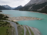 |
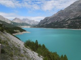
Lake Cancano as seen from the dam of S. Giacomo di Fraéle 27-07-2023 15:39 10.2786°E, 46.5358°N, 1950m |
 |
View through the Bocchetta to Monte Cornaccia 27-07-2023 16:01 10.3142°E, 46.5128°N, 1955m |
 |
Cima de Piazzi as seen from the Bocchetta 27-07-2023 16:02 10.3142°E, 46.5128°N, 1955m |