
 Tour 2024, stage 2: Chatillonne - Mont Tournier - Col du Chat - Alby-sur-Chéran (23 August 2024)
| 2230 m ^ | |
 |
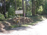
Prémeyzel pass 23-08-2024 09:08 5.6614°E, 45.6844°N, 365m |
 |
The Rhône river at Cuchet 23-08-2024 09:43 5.6439°E, 45.6344°N, 220m |
 |
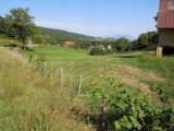
From Duisse towards Le Cerisier 23-08-2024 10:11 5.6672°E, 45.6103°N, 400m |
 |
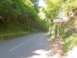
Mont Tournier pass (with 30 m too much on the road sign) 23-08-2024 11:02 5.7094°E, 45.6339°N, 821m |
 |
Le Collet 23-08-2024 11:27 5.7294°E, 45.6214°N, 673m |
 |
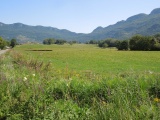
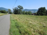
Meyrieux 23-08-2024 12:10 5.7831°E, 45.6419°N, 570m |
 |
Near St-Paul-sur Yenne with Mont du Chat on the right 23-08-2024 12:25 5.7903°E, 45.6806°N, 400m |
 |
Lakes Chevelu and St-Jean as seen from the road to Col du Chat 23-08-2024 12:47 5.8358°E, 45.6919°N, 490m |
 |
At Col du Chat 23-08-2024 13:02 5.8475°E, 45.6928°N, 638m |
 |
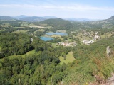
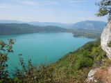
Bourget lake and Hautecombe abbey, with La Chambotte on the horizon 23-08-2024 13:45 5.8317°E, 45.7492°N, 600m |
 |
Road to La Chambotte 23-08-2024 14:39 5.8650°E, 45.7872°N, 490m |
 |
The northern part of Bourget lake from La Chambotte 23-08-2024 14:54 5.8728°E, 45.7769°N, 630m |
 |
Le Goléron 23-08-2024 16:06 5.9994°E, 45.7781°N, 645m |