


Foopass
 |
CH (GL-SG), 9.2381°E, 46.9428°N | |||
 |
2223 m |  |
CH-GL-2223 | |
 |
Elm, 977m, 10km Raminer Matt, 1896m, 2km | |||
 |
Weisstannen, 1004m, 13km Untersäss, 1391m, 7km Foo Alp, 1875m, 2km | |||
 |
 |
 | ||
 |


| |||
 |
(noch nicht auf Deutsch übersetzt:) cyclable depuis Elm jusqu'à Raminer Matt, poussage ou portage en-dessus; long et difficile portage et poussage dès Untersäss sur le versant Weisstannental | |||
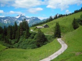
Die Alp Mittler Stafel oberhalb von Elm | ||||

Foopass, Sicht Richtung Weisstannen | ||||

Im langen Abstieg von der Alp Foo nach Untersäss | ||||